By Bernard Mc Dyre
Irish translation: Inis Eoghain, meaning island of Eoghan. Eoghan Mac Neill was the son of Niall of the Nine Hostages, once High King of Ireland.
Buncrana
It’s Saturday morning and it’s time to roll the Caponord out of the garage for the first run of 2016.
Leaving home and heading north to Buncrana on the N13. The N13 runs along the Lough Swilly, a sea inlet which lies between the western side of Inishowen and the Fanad Penisula. Lough Swilly was once the home of the Admiral Jellico’s British grand fleet headquarters during the WWI and also a major waterway for coal boats and exporters of potatoes and cattle up until the 1940s.
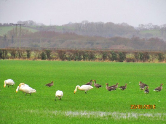
Wild geese and whooper swans at the Inch Island Wildlife Reserve.
In Buncrana, I meet up with my biking buddy for the day, Pat. We discuss our route for the day over coffee in a local service station.
Buncrana is the largest town on the Inishowen Peninsula. Once a naval town, known as HMS HCKLAR, Buncrana later became a major linen producer. Many of the old factory ruins are still visible around the town.
Crossing the Victoria bridge, we take the coastal route out to Fort Dunree. The winding road is enclosed by the Swilly on the left and the Urris Hills on the right. Views of Fanad lighthouse, one of the Wild Atlantic Way signature points, are seen across the Swilly.
Fort Dunree
The road narrows as we approach Fort Dunree.
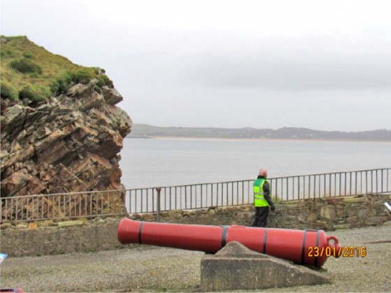
Pat taking in the view from Fort Dunree.
Fort Dunree, located on the shores of Lough Swilly was once a treaty port. There were three such ports in Ireland: Fort Dunree, Berehaven and Cobh both in Co Cork. These ports where held by the British navy under the Anglo–Irish treaty from 1921. They were finally handed back to the Irish Republic in 1938.
Mamore gap
From Fort Dunree, we head for the Urris hills and the famous Mamore gap.
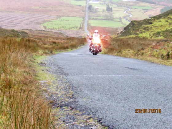
Approaching the top of Mamore Gap.
A long, straight ascent brings you to the top of Mamore gap. There is an area to stop here to admire the breath-taking scenery. Careful of how you park your bike the parking area is quite steep To the North, you are overlooking Urris or the “Poitin Republic of Urris”.
Onward from Mamore gap is a serious of sharp hairpins which were once difficult to navigate by motorbike. In recent years however, the corners have been widened and several viewing stops added making it a lot easier for motorcyclists of any experience. Well worth it alone for the views out over the North Atlantic and Dundaff head.
The road flattens out as we leave the gap. The weather has been kind so far, slightly overcast but mild with no wind. Good January weather by Donegal standards. We ride past a beautiful thatched cottage and many modern houses but one building stands out for me – a blue stone barn to my left with bright red doors.
Time for a break.
Heading for Clonmany, Carndonagh & Malin Town
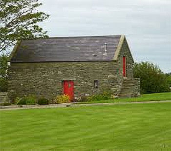
Dream home…
Next we pass through the 18th century plantation towns of Clonmany, Carndonagh and Malin town. Each of these would have been close to the manor house of the area and would have had local markets would have been held in the towns’ triangular centres.
Leaving Carndonagh we cross the bridge into Malin town, a previous winner of Ireland’s Tidy Town’s competition. It’s not hard to see why as even on an overcast day in January the village looks beautiful and tranquil.
From Malin town the road becomes bendy again as we ride along the water’s edge passing two whitewashed churches at Lagg. Our next stop is at the Knockamany Bens, a large parking area overlooking Five Fingers Strand and the Isle of Doagh.
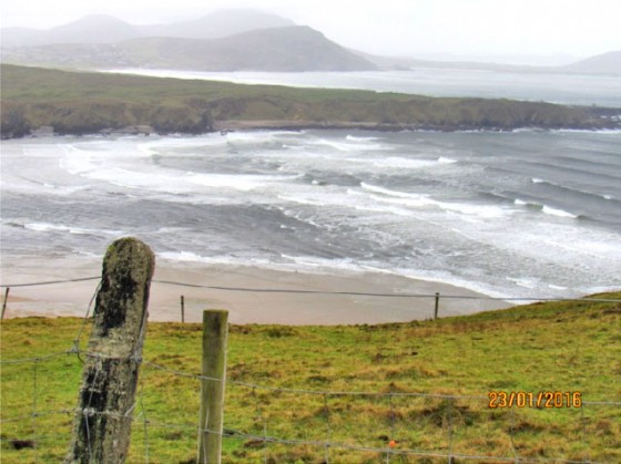
Too choppy for a swim on Five Fingers Strand. I’ll leave it for another day.
As we make our way to Malin Head, our riding skills are tested on sharp corners, narrow roads skirting sea cliffs and covered with sand and seaweed from winter storms. It’s all worth it though, to get away from the bustle and groan of traffic!
Banba’s Crown
In the distance, we can see Banba’s crown, situated at Malin head Ireland’s most northerly point and the beginning of the Wild Atlantic Way. Banba crown was named after one of the three mythical queens of Ireland the others being Fodla and Erin. Looking north from here, you can see Inistrahull, once the most northerly inhabited island in Ireland.
From here the only way is south so we make our way towards Malin town again. The roads are quiet and peaceful.
Pat and I part ways in Carndonagh and I depart for home. This time, on Pat’s advice, I take a mountain road back to Letterkenny through Quigley’s Point. Despite being a shorter route, the mountain road has a great riding surface and some brilliant, sweeping corners with local sheep acting as the only street furniture around. It gave me a chance to open her up a bit after the slow riding earlier in the day. At the top of the mountain, the colour of the heather and the whin bushes overpower the greyness of the oncoming rain.
I pass the North Pole pub on my way through Buncrana On to Bridgend and into the Gap Coffee shop for the best coffee in Inishowen (if not Donegal).
Full of coffee and the night falling in I return home happy. The first decent run of 2016 – done. It’s going to be a good year.
True North Bike Tours
Email: truenorthbiketours@gmail.com
