Day 1. Saint-André-les-Alpes to Briancon via Gorges de Daluis, Colle della Lombarda, Col de Larche/Madeleine and Col d’Izoard
Distance – 280km
I only had a window of a few days for this trip as a trip to the West of Ireland and two more to the Pyrenees earlier in the year was starting to drain my wife’s patience, but I fully intended to make the most of it. I kicked it off with a route starting in Saint-André-les-Alpes at the head of Lac du Castillon which feeds the Gorges du Verdon.
Leaving town south along the lake then west on the N202, the legendary D902 is soon met at the junction of the D4202 and Route des Alpes where the fun commences at the bottom of the blood red Gorges de Daluis.
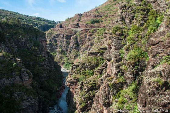
Gorges de Daluis
The Gorges de Daluis is a six-kilometer-long canyon formed by the river Var which cuts through red rock coloured by iron oxide. South from Guillaumes, the D902/D2202 runs on the west side of the gorge, with the southbound lane going through 17 tunnels.
The now defunct Alpes-Maritimes railroad line from Pont-de-Gueydan to Guillaumes, inaugurated in 1923, runs east from Guillaumes and crosses the gorge at the Pont de la Mariée, spanning 58 meters. Bungee jumping is done from the 80-meter-high bridge, you can’t miss it as there are usually a fine selection of motorbikes parked here. You should stop here for a few photos as the views from the bridge are breathtaking.
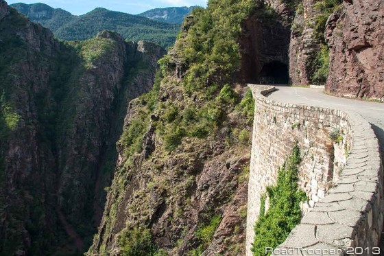
Gorges de Daluis
Daluis is a spectacular road but not the only one in the area, 20km to the west is Gorges du Cian (D28) which runs the same direction, from the D6202 up to Beuil and so can also be used for this route. Both roads are best ridden from the bottom to top – south to north as it lessens the risk of you warping your break disks. Daluis is probably the most photogenic of the two, but don’t miss the chance of riding through Cian if you can as it’s a blast to say the least.
Upon entering Guillaumes I took the D28, a twisty ride through the picturesque high country west to the ski resort of Valberg then on to Beuil for a coffee and a fuel stop. So far it’s a pleasant route, from the tiny petrol/coffee station in Beuil I take the D30 north and drop into the Col de la Couillole which some local bikers had tolled me about many years ago. This col has little traffic as few bikers find their way here, but it is well known locally and for the classic car rally’s that run through it in the summer. Parts of this col are quite spectacular, it’s a shame more riders don’t find it.
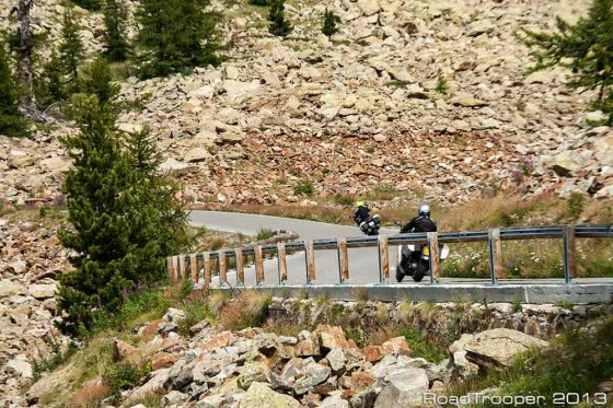
Colle del la Lombarde
Col de la Couillole exit’s at Saint-Sauveur-Sur-Tinée where I took the M2205 which is part of the main route from Nice to the ski station of Isola. It’s also the main route to/from the infamous “La Bonette” north of Isola. This year however I run west form Isola on the D97 which over the next 20km climbs a staggering 1500 meters and crosses the Italian border at Col de la Lombarde.
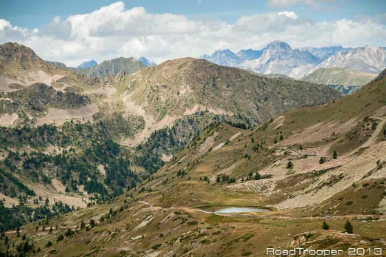
Colle del la Lombarde
As the Lombarde summit at 2350m is crossed stopping the bike is a must for the views ahead are simply jaw dropping, The road (Strada Provenciale SP255) ahead cuts its way across the alps almost as far as my tired old eyes can see. I get really fed up describing Alpine roads as epic, but damn it I can’t find a better word!
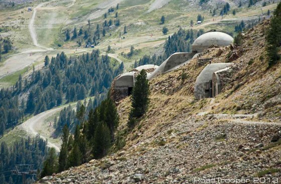
Colle del la Lombarde
Following some stupidly beautiful alpine vistas the SP255 eventually spits me out on the SS21. This little beauty snakes its way through more eye wateringly pretty Italian views before a belter of a ride involving 14 hairpins taking me in to Col de Larche, or Colle della Maddalena depending on your point of view.
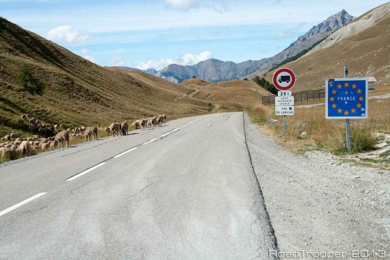
Col de Larche
I passed an interesting 15 minutes stuck near the summit watching a lady holding a new born baby smoke 3 cigarettes in a row as she held up traffic while her mates squeezed what looked like 400 sheep into a Ford Transit. You can see some of the oddest things on a road trip…
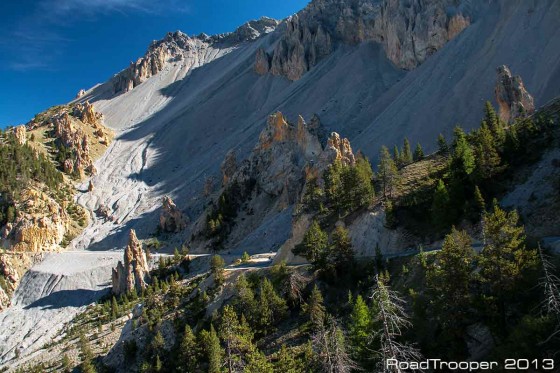
Col d’Izoard
Before heading into Briancon for the night there was one last great pass, the exotic looking Col d’Izoard, a pass with some very bizarre rock formations known as the Casse Desert (Broken Desert).
I must have ridden through it 50 times over the years, but I never get tired of it.
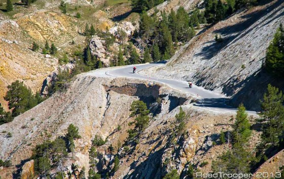
Col d’Izoard
Day 2 Briancon Loop via Cols Lautaret, Glandon, Croix de Fer, Telegraph and Galibier
Distance – 219km
There is no real point describing this route in too much detail as most of these cols here are so well known. However this particular route has a rather special little stretch of road, the D211A which is not for those who fear heights as this road is just plain bonkers.
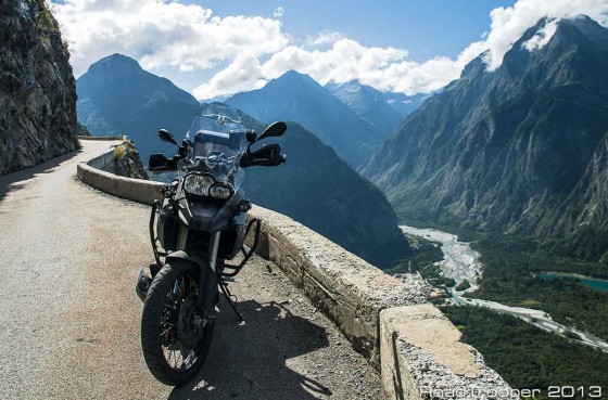
D211A Near Bourg D’Oisans
Just past the Col du Lautaret you take a right off the D1091 to the D211A at the village of Le Freney-D’Oisans.
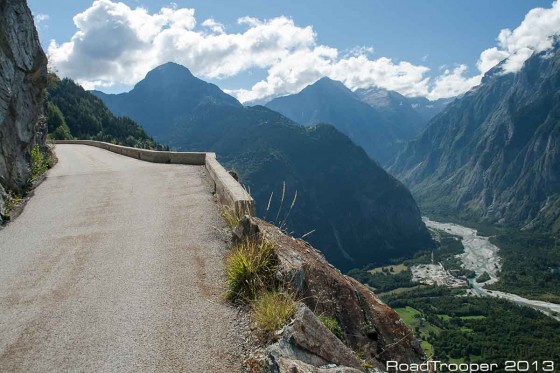
D211A Near Bourg D’Oisans
Initially the road winds up through forest and a couple of hamlets before narrowing, she then cuts along a cliff face where there is only a foot high wall separating you and a sheer, base jumps wet dream, drop to the valley below.
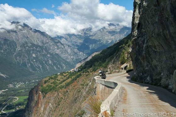
D211A Near Bourg D’Oisans
It’s a mind numbing vertical drop of 550 meters so you might want to give it a miss on a windy day. There are not many roads like this in Europe, if you can handle the height and the prospect of a very long freefall this road absolutely HAS to be on the list of any road connoisseur.
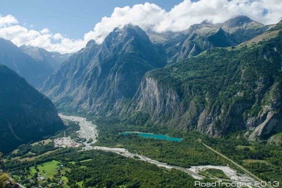
View from D211A Near Bourg D’Oisans
Day 3. Briancon to Saint-André-les-Alpes via Cols d’Izoard, Cayolle and Champs
Distance – 207km
Alternate Route – Briancon to Saint-André-les-Alpes via Cols d’Izoard, Allos, Champs and Gorges du Daluis
Distance – 171km
I’d planned to return to Saint-André-les-Alpes via Col du Cayolle (D902) and Col du Champs (D2). Col du Cayolle is actually one of my favourite alpine passes in France but not so for everyone. Actually many hate it as some sections of the road should not be called a road at all. But as I was now on a F800GS the rougher roads have become the route of choice. Anyone on a pure road bike is unlikely to enjoy it unless it’s the scenery your after.
The road through this pass is really is stunning in its beauty but the road is very rough in places, or at least it used to be. Unfortunately this day the pass was closed for maintenance just south of Barcelonnette as it was the last time I’d been through here. I only had two other interesting routes south from Barcelonnette, either via La Bonette or a far shorter route via Col d’Allos (D908) which is what I chose as my main destination for today was Col du Champs accessed at Colmars at the south end of Allos. Here is the amended route:
Col d’Allos (2250m) is enormous fun in it’s own right providing everything you imagine a high alpine pass should. Stunning views, a rough cliff hanging section, a coffee shop at the top and smooth switch backs on the other side descending into the ski station. From here it’s a pleasant run down to old walled town of Colmars which is well worth a visit if you have the time.
Col des Champs is accessed by the D908 then D2, a very small and unlikely looking road hooking off to the left just before you come into Colmars. It looks more like someone’s driveway, just keep an eye out for the sign and go with it. Champs is another old favourite of mine as it has two very different faces.
From Colmars it’s a slow, rough, twisty road through forest. Nearing the summit however things get ever more interesting as the trees fall away revealing a lunar landscape. The road here gets narrower and rougher again with the crumbling edge falling away into the deep valley below where your screams for help will undoubtedly go unheard if you fail to stay on track.
The southern ramp is a completely different story however where fast, smooth curves await. The difference is total and slightly bizarre. From here is was a fun run back to the hotel via Guillaumes and the Gorges du Daluis.
Day 4. The Gorge du Verdon North, Greolieres, Gourdon, Verdon South
Distance – 254km
This day started with an early morning jaunt along Route de Crête (D24) which is a loop road off the D952 that gives some of the best and most spectacular views into the Gorges du Verdon. It’s always best to ride this bit of road before it fills up with endless lines of camper vans, as the road is narrow with plenty of blind corners there are few opportunities for overtaking safely.
From here I doubled back and headed towards Greolieres to ride some of roads around this wonderfully empty area of inner Provence. If you decide to follow this route you might just recognise some of these roads. A number of movie car chases were filmed up here, but it’s a fun ride even without that. Even in the summer tourist season this area sees little traffic as it’s known for its ski station in Greolieres des Neige more than anything else. The road up to the ski station was in GoldenEye while the roads nearby were torn up during the car chase in the Robert de Nero film “Ronin”, notably the cliff road above the village of Greolieres itself.
From here I swung down the cliff top village of Gourdon (visit if you can) then back up into inner Provence and along a section of Route Napoleon before taking the southern road along the Gorges du Verdon. Except for the gorges and around Castellane this route was devoid of traffic providing easy swift riding through beautiful, deserted countryside on smooth curvy roads. A perfect days riding in my book. I ended the day by staying the night in Auberge des Salles, in the small village of Les Salles-sur-Verdon where my room open up to magnificent views over Lac Sainte-Croix. There are a few other hotels in this quiet lakeside village along with a few restaurants catering to everyone’s tastes and budget. I’ve put it on my “return to” list.
Day 5
It was time to leave the French Alps for this year and I had to start making my way back towards Torrevieja. Luckily for me the Pyrenees were in the way of my path home. Nothing to report of interest this day however, it was mostly motorway all the way to Saint-Beat in the Midi-Pyrénées.
Day 6. (Route des Cols, D-928) Cols Portillon, Aspin, Salour, Tourmalet, Aubesque and Pourtalet
Distance – 280km
Oh my aching head! I’d stayed again in Chalet Le Chapeau Bleu just outside Saint-Beat and the previous night had turned into an impromptu piss-up with the owners, Carole and Ron and a few other guests. Earlier in the year I had planed a run along the French Pyrenees which I was forced to cancel due to dangerously bad weather. It was not looking too good this day either but I was damned if the weather or a hangover was going to stop me this time.
This route I’ve ridden before in some shape or form and runs mostly along the D918 (Route des Cols). I’ve not got much in the way of video or photographs this time as for the most part the cloud was so thick I’m not sure where I was for the most of it. Tourmalet I can say is an interesting experience when visibility is down to about 5 meters ![]() Luckily the sun broke through and the cloud buggered off as I rode over Col du Salour and into Col d’Aubesque. That night I had a well deserved rest in the superb Hotel Pradas Ordesa back in Broto which put me in good shape for the long run down through central Spain and home to Torrevieja.
Luckily the sun broke through and the cloud buggered off as I rode over Col du Salour and into Col d’Aubesque. That night I had a well deserved rest in the superb Hotel Pradas Ordesa back in Broto which put me in good shape for the long run down through central Spain and home to Torrevieja.
Roll on 2014…


G’day Denis
Just took a look at “2015/16 F800GS Adventure Season Trailer – Spain to Ireland’s West Coast” on your YouTube channel, wow! that took me back twenty-odd years, but scary when you switched from driving on the right to the left side of the road and GS to GSA! The editing is terrific, the music fits and the ride . . . .
I left the UK a dozen or so years ago with my wife, youngest son and a R1150RT with 125,000 miles on it to semi-retire in Western Australia and have never looked back. W.A. doesn’t have a surfeit of twisties but it does have solitude that is so, so good for the soul. I’ve traveled for over two days at a time and never seen another vehicle or person. This video done by a mate gives a taster, I’m in there somewhere;
http://www.youtube.com/watch?v=GkM1x5Yzerw
Spain is very much like Tasmania. I did a bit of Tassie in November 2014 on the BMW GS Safari with a mate, covered a little over 10,000kms in three weeks. There are no short trips here! I’m not keen on big groups of riders, four is plenty but there were 240 on this one. After the first day I buggered off on my own most days.
Have a look at:
http://www.youtube.com/watch?v=XnPHjB19jl4
for a video done by a mate, the bloke I rode over there with and;
http://www.youtube.com/watch?v=jhtBJTLxnkw
for the official/professional version done by a bloke called Adam Riemann, this bloke can ride the wheels of any adventure/dirt bike with a camera in one hand – bastard!
There are a few clips of the TS (Road based) Safari that ran the previous week included.
Good health and happy days, Chris
Cheers for the links Chris, I enjoyed watching them. Tas looks like it would be right up my ally..
Aus is on my to-do list, I have a good mate that lives in Cairns I’ve been promising to visit so I’ll be shipping one of my bikes down there at some stage…
Happy trails..
D