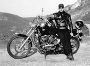
Some of these passes I covered last year in which case I’m not going into too much detail blabbing on about them. For the 2011 trip I filmed the roads with a Drift HD170 Action Camera, I hope the videos attached to this blog will help you see for yourself what to expect better than what I can describe. For more info on the area’s covered, hotels, B&B’s, campsites etc you can check back to the 2010 trip report.
However you will find updates here inc. photos and downloadable GPS routes.
Download This Route »
Note: You will be asked to log in or register with RoadTrooper.com to gain access to downloadable .KML (Google Earth), .GDB (Garmin), .GPX (Generic) files.
This was a big day, heading south over Col d’Izoard, along Canyon du Combe de Queyras then over Col du Vars to Col/Cime de la Bonette (the highest through road in Western Europe), Col de la Couillole/Roubion, Gorges du Cians then on to Saint-André-Les-Alpes at the herad of the Gorge du Verdon. Only 290km and might not sound like much, but in the Alps I’ve found that to be a long day.
Col d’Izoard Alt 2,361m
Part of the Parc National du Queryas, the D902 runs south out of Briancon following a river to a small village of Cervier, crossing the river the D902 for the most part becomes a smooth winding swift stretch of road through alpine pastures and forest, a joy on whatever motorbike you ride.
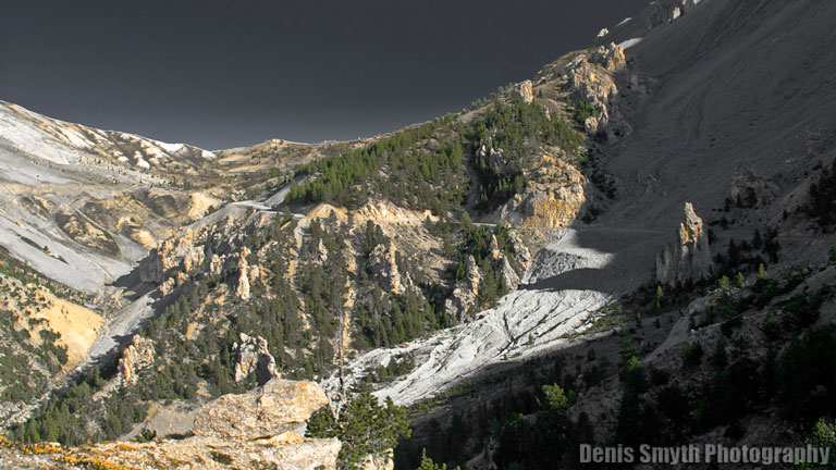
Col d'Izoard
About 2km up and south of Cervier is the Auberge de Larpin where I never fail to stop for at least a coffee, but it also offers alpine style food and accommodation and has a real rustic alpine style which I love, the owner speaks good English and they are well used to catering for bikers. From here it’s about 9km along a picture perfect road to the saddle of Col d’Izoard where you can find the usual stunning views to the north and a panorama of eye watering views of the Southern Alps sloping off towards the Cote d’Azure. Early morning is the best time to be up here as it tends to fill up with pedal pushers in skin-tight lycra hideously stretched around their junk and recklessly lowering their sperm count. Oh bugger, there I go again, I promised to stop “peddle bashing”, sorry…
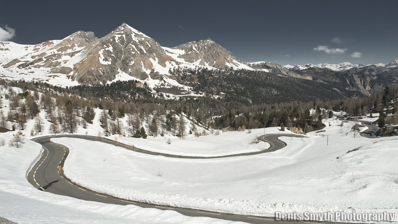
Col d’Izoard view north towards Briancon
The southern slope of Izoard has always been a special spot for me, it’s more then just another gravity defying slip of tarmac precariously strapped to the side of a cliff overlooking a vertigo inducing precipice. This part of the D902 runs along forbidding and barren scree slopes with protruding pinnacles of weathered rock all along the upper south side called the Casse Desert, it really is quite bizarre and if the clouds are down and around you as you carve your way along, it become eerily disturbing in some primeval other worldly way. If your into photography you should plan to spend an hour or two walking along this stretch snapping away at this wonderful weird spectacle, there really is nowhere else like it.
Gorges Combe de Queyras
From the Casse Desert down the road is fairly quick if not uneventful, the road is quickly enveloped by forest so you can say goodbye to the views and concentrate on the road. Keep an eye to your rear view however and don’t be surprised to see a cyclist attempting to overtake you, some of those lads can peel off the mountain at blistering speed.
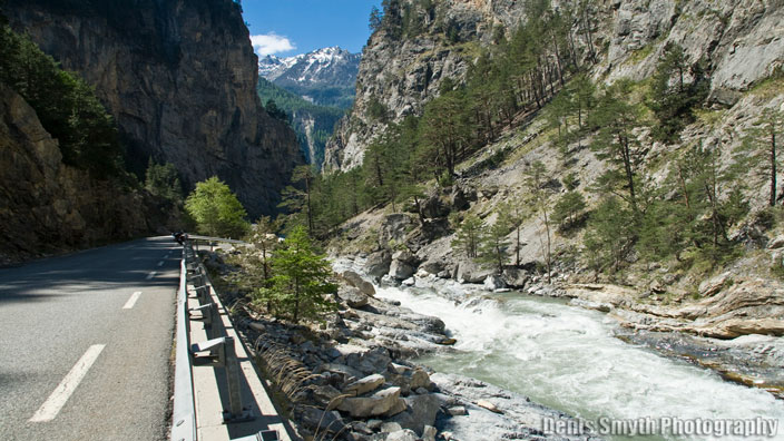
Gorges Combe de Queyras
Just south of the hamlet of Arvieux you come to a T junction, you can go left onto the D947 which will bring you firstly to Chateau Queyras, another old fortification about 2km from the junction and worth a sniff around. From there you can continue on the D947 for 5km to Ville-Vieille and take the D5 up to the High Alpine village of Saint-Véran which has a “how lost am I?” vibe going on. You could also plan to spend the night here as it holds the highest hotel in the Alps, Chateau Renard just out and up from the village. Not the cheapest spot in the Alps, but the views from the veranda and 1st class food make it worth every penny. If ye have the wife riding pillion this would be a welcome break and earn you a few brownie points. Book well in advance though; it’s a popular spot with the French and Italians and it’s closed off-season. From here you can cross over into Italy via the Col dell Agnello which I can’t recommend enough and a must if your staying in Saint-Véran.
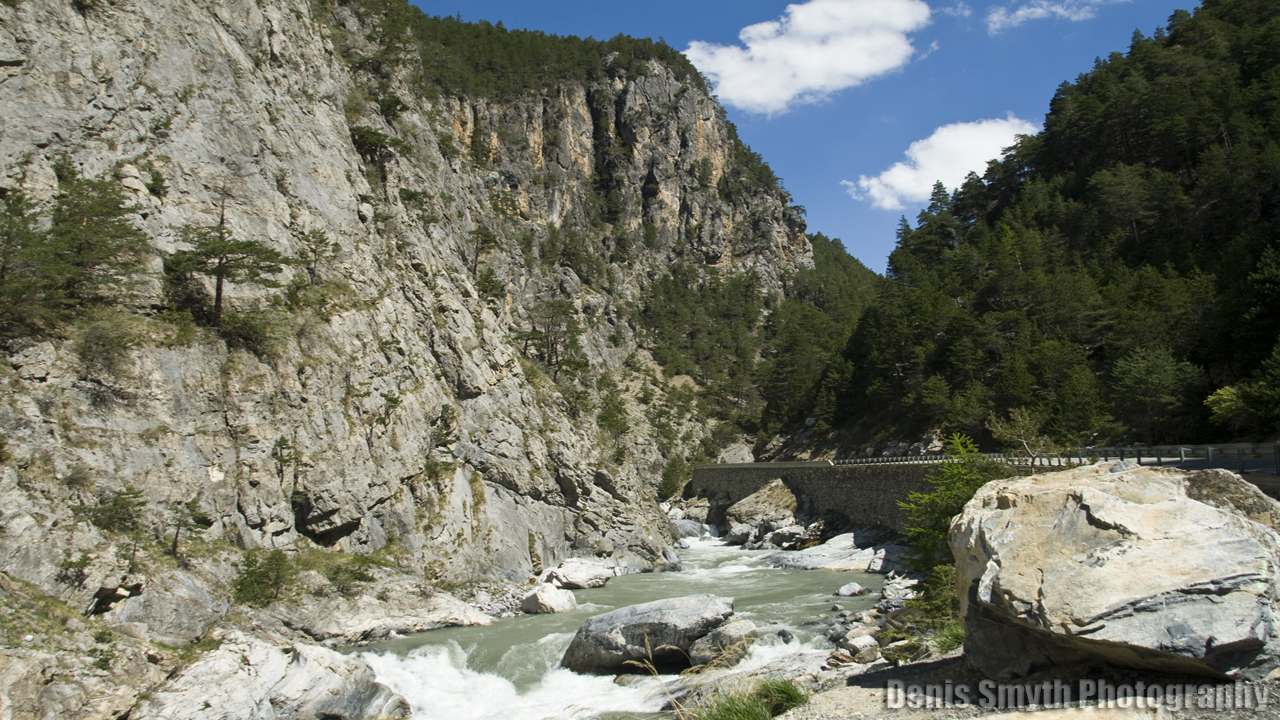
Gorges Combe de Queyras
This year however I took the right at the Arvieux T junction and continued along the D902 through Canyon du Combe de Queyras that brings you around the edge of Guillestre where you can visit the huge fortifications of Mont Dauphin. The whole stretch of road towards Guillestre follows the Guil River through a series of canyons, it’s a mixed road of smooth and swift with a narrow section clinging to the edge of the canyon which can be a little unnerving.
Col du Vars Alt. 2,111m
Just before Guillestre the D902 swing back south over the Col du Var, this particular col is not the most exciting but there’s a few spots along the way to grab a coffee.
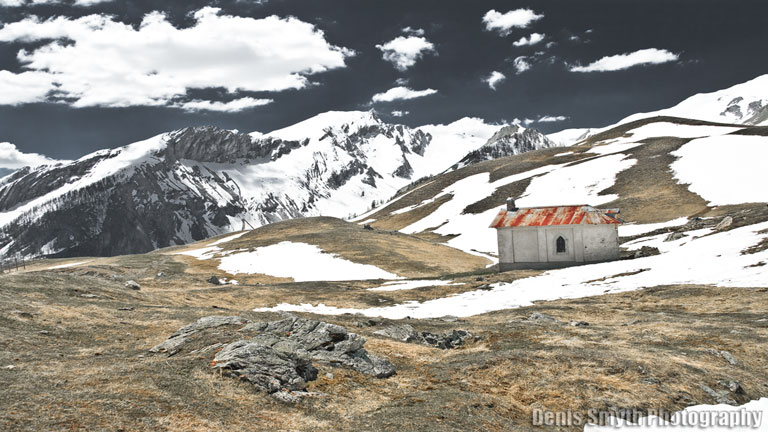
Col du Vars
Coming down the south side of the Var you will however notice the landscape and climate changing as from here on in you are well into the Alpes-Maritimes and Alpes-de-Haute-Provence, an area of south-west France created by Octavian as a Roman province in 14BC, the northern Alps are now behind, but this section is far from over.
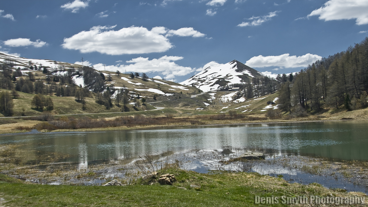
D902 through Col du Var
A good road with mixed scenery, but watch out for HGV traffic. Just passed the pretty village of Saint-Paul-Sur-Ubaye the road forks, the D900 brings you into Italy over the Col de Larche (Alt. 1,996m). The D902 brings you to Jausiers and Col de Bonette. South of the Col du Var you will meet a T junction where the D902 joins the D900 and from here you have a few choices on the route south. Go left and you can ride over the Col de Larche into Italy. Go right and past Jausiers will bring you in Barcelonnette, from here you can access Col d’Allos, Col de Champs or Col du Cayolle which will bring you just west of Valberg on down the Gorges de Daluis all of which I covered last year so you can read back for more info on them.
Col de Bonette Alt. 2,860m – 9,383ft
This year I took the road south of Juusiers over one of the greatest passes. The locals say if it’s raining in Jausiers than its snowing on La Bonette, it’s easy to see why, La Bonette is only 20km away but almost at a 2km higher altitude. Col de la Bonette, a section of which is called Cime de la Bonette (Cime means summit in French) which is the highest paved through road in the Alps at an altitude of 2860m.
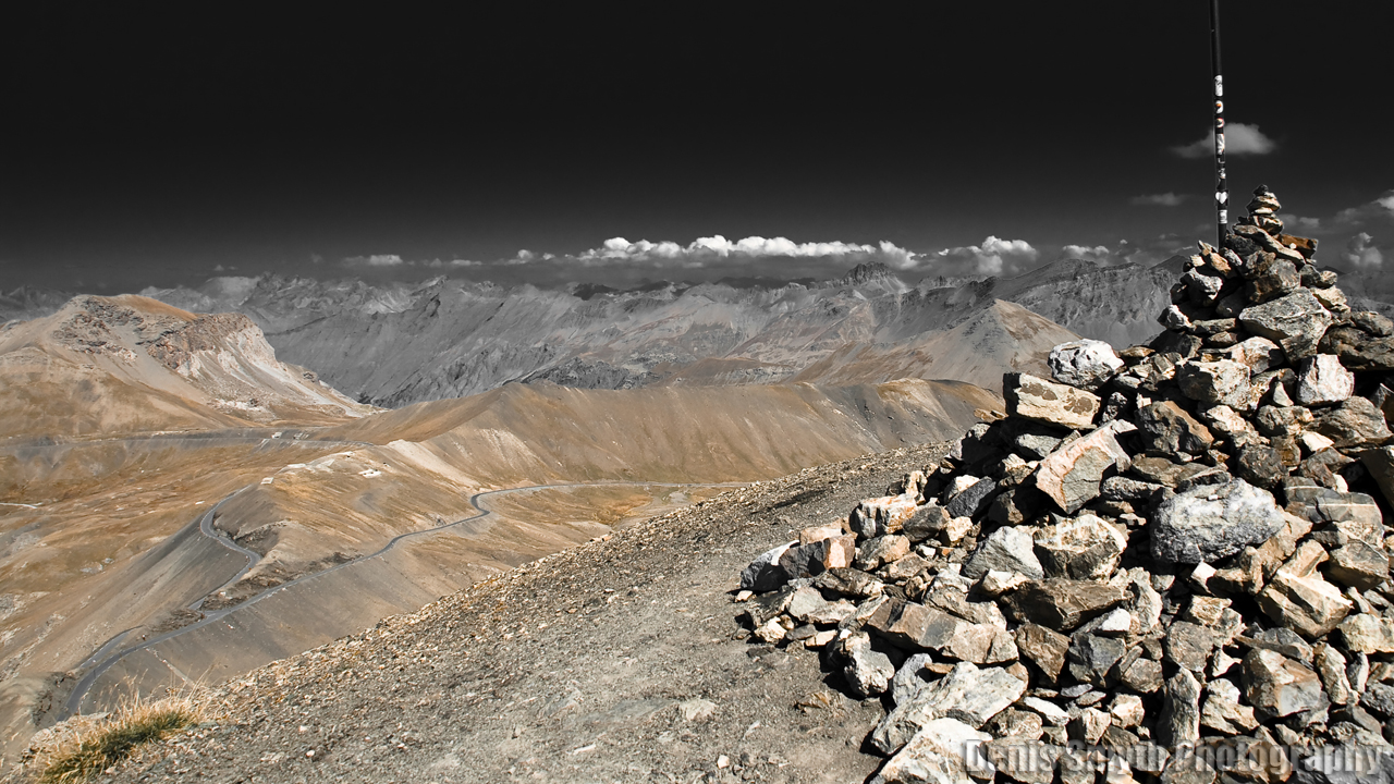
View from summit looking over the northern ramp of La Bonette
From Jausiers the road is smooth enough but as it climbs there are a number of tight hairpins which are a complete pain in the arse on the heavy RT and yet again I found myself wishing I had my F800R for this work. The hairpins slow things down a lot so I’ve edited them out of the video. For every 10km you ride the altitude rises 1km, it’s steep and the upper section “La Cime” is completely bonkers, my vertigo was kicking in with a feeling of refined terror, outside of an aeroplane this was the highest I’ve ever been. But as much as I complain about the weight of my RT she ploughed up that rock like a drunken mountain goat.
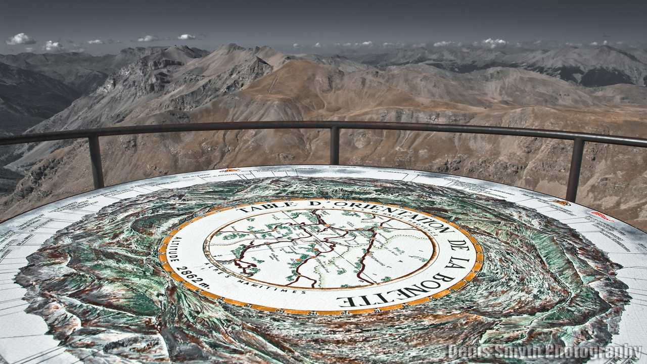
Summit of La Bonette
I wont blag on about the views at the top, but I did meet an interesting young lad from Norway chillen out at the top in battered old leathers handed down from his dad. He had ridden all the way from Norway, through Sweden, Denmark, Germany and around via Czech, Austria, Liechtenstein, Switz, Italy and finally to La Bonette, camping on the roadside more often than not. An impressive tour by any standard, but get this, he started out only 2 days after getting his full licence and was doing all this an a BMW single cylinder F650GS as worn as his leathers, and he was only half way through his tour!! And there was I moaning about the weight of the RT, what a middle-aged pussy was I? In the 20 minutes I was talking to him I first thought he was barking mad until I realised he had taken his motorbike trip back to it’s oldest and truest form of honest, wide-eyed adventure touring, low-budget and without the frills. Fair fecken play to him….
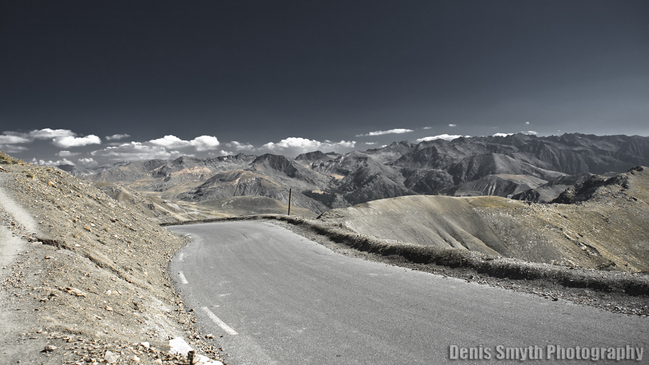
Cime de la Bonette South Ramp
Riding down the south slope I thought to myself, next time I start bitchen about the RT’s weight I should first think about shaving some weight off my own fat ass and remember how lucky I am to have an RT in the first place!!!!
Col de la Couillole Alt. 1,678m
From the summit of Bonette it was a 50km run on the D2205, a mostly good fast road to Saint-Sauveur-Sur-Tinée. You can follow the D2205 right down to the coast, far better however to turn off at Saint-Sauveur-Sur-Tinée and up towards Valberg via Roubion and Col de la Couillole on the D30. This col is one of Provence’s hidden secrets known mostly to the local bikers and I only found it years ago by accident.
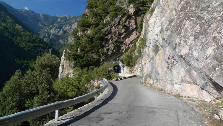
Col de la Couillole
The first section of the road is very narrow with some extremely tight hairpins clinging onto a steep mountainside but the views down into the valleys below and it’s remoteness make the effort well worth it, but as it’s off the traditional bikers route it’s sadly missed by many. As for Roubion, a village about half way to Beuil, it’s one of those places that fascinates me as I cant for the life of me figure out how people make a living or survive up here. It’s not really that far from Nice, but seriously, you might as well live on the moon and inbreeding must be a worry. Hoping not to meet any weird kids playing banjo’s I dont hang around and ride on through Col de la Couillole into Beuil. This col gives you access to two routs back to the south, from Beuil you can follow this amazing road to the ski station of Valberg on the D28 and then down the Gorges da Daluis which I covered in my 2010 trip report. This year I took the D28 south from Beuil down the roller coaster of Gorges de Cians, a 20km stretch of sheer break pad melting exhilaration. See for yourself and check out the vid!

The village of Roubion
Gorges du Cenis
From Beuil I join the D28 where I have a choice of heading west on the D28 into Valberg, Guillaumes and down Gorges de Daluis. This stretch of road is fantastic and Gorges de Daluis (covered in 2010) is not to be missed either with great road and dramatic scenery. Ciens however I had not ridden since 2001, so from Buiel I took the D28 south down Gorges de Ciens and oh how I’d forgotten how good this road is. The gorge cuts through red limestone cliffs with a fast twisty mostly smooth road. By the time I got to the bottom with my adrenalin running riot I had to stop to let my breaks cool off. Gorges de Cians is a 20km stretch of sheer mind melting exhilaration. See for yourself and check out the vid!
From here it was along to Puget-Théniers, the N202 and on to Saint-André-Les-Alpes at the head of Gorges du Verdon for the night. The N202 is a commercial and touristy road, smooth and straight it’s easy to pick up speed, keep a close eye on your speed however all along this stretch as its full of hidden gun-toting Gendarme’s looking to catch your money. At this point I’m also feeling a little sad as I’ve now left the alps for another year, it’s all seemed to have shot by so quickly. Luckily I’ve a long way to go yet so I head to the Hotel Bel Air in Saint-André-Les-Alpes where I know I’ll get good food, good beer and a good nights sleep before heading west to Gorges du Verdon and the great bald mountain of Mont Ventoux before heading to the Pyrenees.
Download This Route »
Note: You will be asked to log in or register with RoadTrooper.com to gain access to downloadable .KML (Google Earth), .GDB (Garmin), .GPX (Generic) files.
Next: 2011 Alpine and Pyrenees Tour. Day 6
