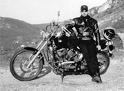
Assuming you’re legally and physically capable of riding a motorcycle after a night in Matt Molloy’s in Westport (see previous post) this next stretch of the WAW brings you south towards Clifden and the mythical landscape of the Connemara National Park in Galway.
Posts with the Tag 'GPS Routes Ireland'
The 2011 motorcycle riding season is well and truly dead, so I’m back for another winter to keep your motorbike spirit alive with ideas, photos and videos to help plan your tours for next summer. The website will be continually improved and your feedback and ideas for it are welcome so don’t be shy… It’s [...]
Route description and places to stay along Stage 1 of this great Alpine tour. Stage 1 – Thonon-les-Bains to Grand Bornand Distance – 90km This stage passes by Morzine, Gets, Taninges, Cluses, Le Grand-Bornand Cols – Col de Gêts 1163 meters, Col de la Colombière 1613 meters Cols (Stage 1b) – Col du Ranfolly, Col [...]
This route starts just outside of Rathdrum simply because the stretch of road from here to Laragh is a great bit of crack if it’s quiet, there are a couple of really tricky turns on this road close to Rathdrum, you will know what I mean when you try them. Best to ride it slowly [...]
As a landscape photographer I get to spend a lot of time in the Dublin and Wicklow mountains and have gotten to know many of the most scenic back roads. So if you’re in the area why not check them out, as they are all within an hours drive from Dun Laoghaire port.


