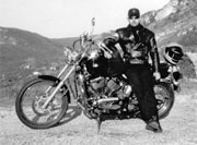
Picture this: You’ve finally got your annual free pass and now you’re back on two wheels, heading south roaring through picturesque landscapes, fueled by adrenaline, and destined for adventure. Slapped between France and Spain, the Pyrenees mountain range stands a monumental testament to the forces of nature, its majestic rugged battlements a captivating playground for [...]
Posts with the Tag 'GPS Routes France'
My 1st full self guided motorcycle tour of the Pyrenees is based on both my guided tours and my own explorations over my 12 years living in Spain/France and works in exactly the same format as my .gpx motorcycle routes for Ireland.
Route Description – From Carcassonne through Cathar country, entering Spain through one of the highest passes, ending in Andorra la Vella Distance – 470km of mostly Pyrenees mountain roads with 11 great Cols Cols/Passes – Col de Portel (1,432m), Col de la Crouzette (1,246m), Col de Péguère (1,375 m), Col de Port (1,249m), Port de [...]
Route Description – The Camargue Circuit runs from Arles to Saint-Maries-de-la-Mer through the Camargue National Park and back to Arles. Distance – An easy 140km
Route Description – Monastery, Castle, Open Country Road and Provencal Village Circuit. Starting outside Signes near Toulon this a great motorcycle route through the back country of Provence known mostly to the local bikers. Cant really recommend this route enough, it’s a really magic mix of smooth open country roads, typical old villages with a [...]
Route description and places to stay along Stage 1 of this great Alpine tour. Stage 1 – Thonon-les-Bains to Grand Bornand Distance – 90km This stage passes by Morzine, Gets, Taninges, Cluses, Le Grand-Bornand Cols – Col de Gêts 1163 meters, Col de la Colombière 1613 meters Cols (Stage 1b) – Col du Ranfolly, Col [...]


